By the Hurricane Watch Editorial Team at Water Gate Systems, LLC Published April 2026 | Water Gate Systems, LLC (BBB Accredited Business, Veteran Owned and Operated)
SEASON AT A GLANCE
- AccuWeather projects 11-16 named storms, 4-7 hurricanes, and 2-4 major hurricanes (Cat. 3+).
- TSR’s December outlook calls for a near-normal season with 14 named storms and an ACE of 125.
- El Niño conditions may suppress overall activity but the Gulf Coast and Carolinas remain elevated-risk targets.
- FEMA’s National Flood Insurance Program, which underwrites all federal flood policies, currently covers 4.7 million properties representing $1.3 trillion in exposure.
A Brief History of Hurricane Forecasting
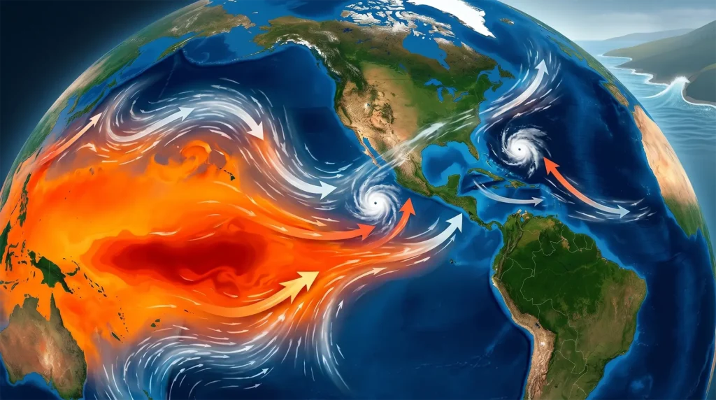
Hurricane forecasting is one of meteorology’s most consequential disciplines and one of its most technically demanding. Before the satellite era, scientists had almost no way to track storms that formed far out at sea. Ships sent back position reports when possible, and land-based weather stations recorded pressure drops as storms approached the coast, but the first warning residents might receive was the darkening sky overhead. Forecasting, such as it was, rested almost entirely on pattern recognition and a forecaster’s personal experience.
The modern era of hurricane prediction began in earnest following the catastrophic Galveston Hurricane of 1900, which killed an estimated 8,000 people and remains the deadliest natural disaster in U.S. history. The tragedy prompted the U.S. Weather Bureau predecessor to today’s National Weather Service to dramatically expand its network of weather stations and telegraph-based warning systems. Aircraft reconnaissance missions began in 1943 when USAF Lt. Col. Joe Duckworth famously flew into a Gulf of Mexico storm to prove it could be done, pioneering the ‘Hurricane Hunter’ programs that are still central to forecasting today.
The first weather satellites launched in the early 1960s fundamentally transformed the science. TIROS-1 (1960) and subsequent satellites gave forecasters their first god’s-eye view of storm formation and movement. By 1970, satellite imagery was part of every operational forecast. In 1984, Dr. William Gray of Colorado State University published a landmark paper documenting statistical relationships between large-scale atmospheric and oceanic conditions and Atlantic hurricane activity – making the first true seasonal forecast possible. Gray’s work founded the CSU Tropical Cyclones, Radar, Atmospheric Modeling, and Software (TC-RAMS) program, which has issued annual seasonal outlooks every year since.
How Forecasting Has Changed – and Improved
Fifty years ago, a three-day hurricane track forecast carried an average error of roughly 500 miles. Today, that same window yields errors of under 100 miles – a five-fold improvement driven by three broad advances: numerical weather prediction (NWP) models, satellite and remote-sensing technology, and data assimilation techniques that blend observational data into model initial conditions.
The European Centre for Medium-Range Weather Forecasts (ECMWF) and NOAA’s Global Forecast System (GFS) are now capable of simulating hurricane track and intensity with remarkable fidelity out to 5-7 days. Ensemble modeling running dozens of simulations with slightly varied starting conditions – gives forecasters probabilistic guidance that accounts for uncertainty. The National Hurricane Center’s ‘cone of uncertainty’ graphic, familiar to coastal residents, is derived from exactly this ensemble spread.
Intensity forecasting has lagged track accuracy by at least a decade. Predicting rapid intensification – a 35-knot wind-speed increase in 24 hours remains a notoriously hard problem because it depends on microscale processes inside the storm’s eyewall that operational models only coarsely resolve. However, recent advances in high-resolution inner-core models, AI-based post-processing, and improved sea-surface temperature data have meaningfully narrowed the gap. NOAA’s Hurricane Analysis and Forecast System (HAFS), deployed operationally for the 2023 season, represents the current state of the art.
Table 1. Selected milestones in Atlantic hurricane forecast technology
| Year | Milestone | Impact |
| 1900 | Galveston disaster spurs Warning Bureau expansion | First organized coastal warning network |
| 1943 | First aircraft reconnaissance into a hurricane | Direct storm measurement becomes possible |
| 1960 | TIROS-1 weather satellite launch | Storms tracked from formation in open ocean |
| 1984 | CSU issues first seasonal Atlantic forecast (Dr. Gray) | Long-range outlooks enter public discourse |
| 1990s | NWP ensemble systems deployed operationally | Track uncertainty quantified probabilistically |
| 2005 | Post-Katrina NHC 5-day cone extended from 3-day | More preparation lead time for coasts |
| 2023 | NOAA HAFS operational debut | Highest-resolution intensity guidance to date |
| 2025+ | AI/ML post-processing models in operational trials | Rapid intensification skill continues to improve |
Season: Top 5 Predictive Reports
Five leading meteorological agencies and institutions have released outlooks for the 2026 Atlantic hurricane season. The table below summarizes their projections alongside the 1991-2020 historical average.
Table 2. 2026 Atlantic hurricane season forecasts
(Agencies not yet released as of April 1, 2026)
| Forecaster | Release | Named Storms | Hurricanes | Major (Cat 3+) | Key Driver / Outlook |
| AccuWeather | Mar 2026 | 11-16 (13.5) | 4-7 | 2-4 | El Niño; warm Atlantic SSTs |
| Tropical Storm Risk (TSR) | Dec 2025 | 14 | 7 | 3 | Near-normal; El Niño uncertainty |
| NOAA/NHC | May 2026* | TBD | TBD | TBD | Outlook expected late May 2026 |
| Colorado State Univ. (CSU) | Apr 9, 2026* | TBD | TBD | TBD | First forecast due April 9 |
| UK Met Office | Spring 2026* | TBD | TBD | TBD | Seasonal extended range forecast |
| 1991-2020 Average | 14 | 7 | 3 | Historical baseline (NOAA/CSU) |
Figure 1. Projected Named Storms vs. Historical Average
(El Niño and La Niña averages shown for context)
- AccuWeather: 13.5 (mid)
- TSR: 14
- 1991-2020 Avg: 14
- El Niño Avg (since 1960s): 10
Report #1 – AccuWeather (March 2026)
AccuWeather’s lead hurricane expert Alex DaSilva released the firm’s 2026 seasonal outlook in late March, calling for a near- to slightly-below-average season driven in large part by the anticipated development of El Niño conditions during summer and fall 2026. El Niño typically increases vertical wind shear across the Atlantic basin – the change in wind speed and direction with altitude that can shred developing tropical systems before they can organize into major storms.
Key projections: 11-16 named storms, 4-7 hurricanes, 2-4 major hurricanes (Cat 3+), and 3-5 direct U.S. impacts. Highest-risk areas include the northern and northeastern Gulf Coast and the Carolinas – regions that have historically seen elevated impacts during El Niño analog years such as 2009, 2014, 2018, and 2023.
AccuWeather Warning to Coastal Residents > “It’s very important that everybody from South Texas all the way to Maine prepares equally for each and every hurricane season, regardless of the forecast. Even if it’s expected to be a slightly below-average hurricane season, we can still see major hits across the United States.” – Alex DaSilva, AccuWeather Lead Hurricane Expert
Report #2 – Tropical Storm Risk / TSR (December 2025)
The London-based Tropical Storm Risk consortium issued its extended-range outlook on December 11, 2025 – one of the earliest major forecasts in the cycle. TSR projects a near-normal season with 14 named storms, 7 hurricanes, and 3 major hurricanes, and an Accumulated Cyclone Energy (ACE) index of 125 units, very close to the 30-year average. However, TSR flagged historically low certainty in this early outlook, with the primary source of uncertainty being whether El Niño conditions will materialize meaningfully in the mid-to-late portion of the 2026 season. Warmer-than-average sea surface temperatures across the Atlantic provide a countering influence that could sustain activity even if El Niño suppresses conditions at the basin level.
Report #3 – Colorado State University / CSU (April 9, 2026*)
CSU’s TC-RAMS team the group that continues the legacy of Dr. William Gray’s pioneering seasonal forecasting program founded in 1984 – will release its first 2026 outlook on April 9, 2026. While the official forecast has not yet been published, CSU’s historical track record offers important context: the team’s April forecasts have demonstrated progressively improving skill over four decades, with accuracy increasing significantly with each successive monthly update through the peak season. CSU’s 2025 post-season verification showed that their July and August outlooks were particularly accurate, confirming above-normal ACE values in a season that produced four major hurricanes three of which reached Category 5 intensity. CSU bases its models on 70 years of historical data, incorporating Atlantic sea surface temperatures, sea level pressures, vertical wind shear, and ENSO indices.
Report #4 – NOAA Climate Prediction Center (May 2026*)
NOAA’s Climate Prediction Center typically releases its official seasonal hurricane outlook in late May, just before the June 1 season start. As the federal government’s authoritative source, NOAA’s outlook carries particular weight for emergency managers, insurers, and coastal planners. NOAA characterizes seasons as above-normal, near-normal, or below-normal using cumulative ACE as the primary metric, supplemented by named storm and hurricane counts. Over the past decade, 9 of 10 Atlantic seasons have been classified as above-normal or extremely active a trend driven by persistently elevated Atlantic sea surface temperatures and more frequent La Niña events. The single exception was 2022, which NOAA classified as near-normal.
Report #5 – UK Met Office (Spring 2026*)
The United Kingdom’s Met Office has increasingly emerged as a credible voice in Atlantic seasonal hurricane forecasting, leveraging its global NWP infrastructure and a statistical-dynamical modeling approach that differs methodologically from U.S.-based outlooks. The Met Office forecast is expected in spring 2026. Their approach typically integrates predictions of Atlantic sea surface temperature anomalies with teleconnection patterns linking Pacific ENSO conditions to Atlantic storm formation. In prior years, Met Office outlooks have often tracked closely with CSU and TSR, though with somewhat different confidence intervals due to their reliance on coupled climate models rather than purely statistical analogs.
NOAA: The Science Behind the Forecast
The National Oceanic and Atmospheric Administration (NOAA) sits at the center of the U.S. hurricane forecasting enterprise. Its National Hurricane Center (NHC) in Miami is the sole operational center responsible for issuing watches, warnings, and advisories for tropical systems affecting the Atlantic, Caribbean, Gulf of Mexico, and eastern Pacific. NOAA’s Hurricane Hunter aircraft operated through the Aircraft Operations Center fly into active storms to collect dropsonde data that is assimilated directly into forecast models, dramatically improving guidance in data-sparse ocean environments.
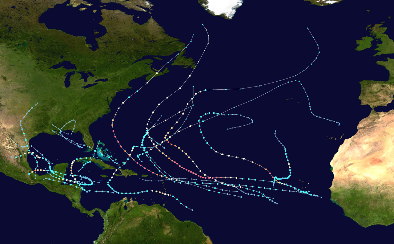
NOAA’s seasonal outlooks draw on the Climate Prediction Center’s analysis of large-scale climate drivers: ENSO (El Niño/La Niña), the Atlantic Multi-Decadal Oscillation (AMO), the West African Monsoon, and stratospheric wind patterns known as the Quasi-Biennial Oscillation (QBO). Each factor modulates the environment across the Atlantic main development region (MDR), the tropical corridor stretching from the African coast to the Caribbean where the majority of major hurricanes originate.
Table 3. Key climate drivers and their projected influence on the 2026 Atlantic hurricane season.
| Climate Factor | 2026 Status | Effect on Season |
| El Niño (ENSO) | Developing mid-to-late 2026 | Increases wind shear; suppresses storms |
| Atlantic SSTs | Warmer than average | Intensification risk; More energy available |
| West African Monsoon | Near-normal | Moderate easterly wave activity |
| Quasi-Biennial Oscillation (QBO) | Westerly phase | Slight suppression of deep convection |
| Atlantic Multi-Decadal Oscillation | Warm phase (ongoing) | Elevated background activity vs. 20th-century average |
FEMA and the National Flood Insurance Program
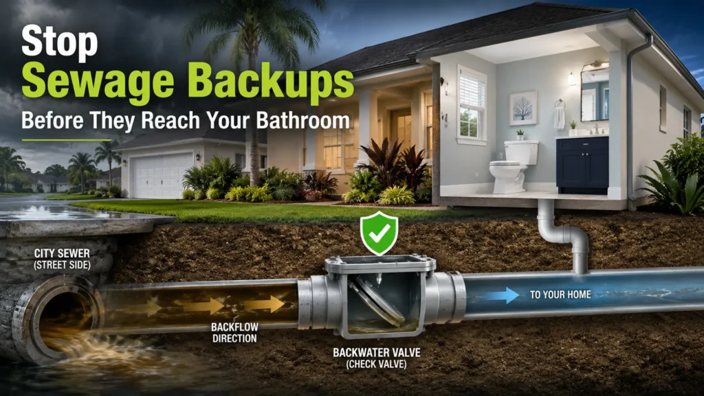
No discussion of hurricane risk is complete without understanding the financial safety net and its limits that the federal government provides through the Federal Emergency Management Agency (FEMA). Most homeowners are surprised to learn that standard homeowners insurance does not cover flood damage. Flooding from storm surge, rainfall, and inland waterway overflow – the primary mechanisms by which hurricanes cause property damage requires a separate flood insurance policy. In the United States, that policy almost always comes from one source: the federal government.
The National Flood Insurance Program (NFIP)
Congress established the NFIP in 1968 under the National Flood Insurance Act, with the program initially administered by the Department of Housing and Urban Development before being transferred to the newly created FEMA in 1979. The program’s dual mandate is to offer affordable flood insurance to property owners in participating communities while encouraging those communities to adopt floodplain management standards that reduce future losses. Today, over 22,600 communities in all 50 states and U.S. territories participate in the NFIP.
FEMA retains full underwriting responsibility for all NFIP policies it is, in effect, the insurer of last resort for flood risk in the United States. Approximately 87.6% of NFIP policies are sold and serviced through 47 private ‘Write-Your-Own’ (WYO) partner companies, but those companies act as FEMA’s fiscal agents; claims are ultimately paid from the National Flood Insurance Fund, a U.S. Treasury account funded by policyholder premiums. Because many consumers interface only with their private agent or WYO carrier, they are often unaware they are actually buying insurance directly from the federal government.
NFIP BY THE NUMBERS (as of December 31, 2025)
- $4.6 billion in annual premium revenue
- 4.7 million active policies
- $1.3 trillion in coverage nationwide
- 22,600+ participating communities
- $22.525 billion currently owed to the U.S. Treasury
- 48% of all NFIP claim dollars paid to just 2.5% of properties (repetitive loss)
A Program Under Financial Stress
The NFIP’s structural finances have been under strain since Hurricane Katrina in 2005, when claims overwhelmed the program’s reserve fund for the first time. The program was forced to borrow from the U.S. Treasury, and repeated major hurricane seasons continued to compound that debt. In October 2017, Congress cancelled $16 billion of NFIP debt in order to allow the program to pay claims from Hurricanes Harvey, Irma, and Maria the first time in the program’s history that its debt was forgiven outright. Despite that relief, the NFIP borrowed an additional $2 billion in February 2025 and currently carries $22.525 billion in debt against a $30.425 billion borrowing ceiling, leaving just $7.9 billion in remaining borrowing capacity as the 2026 hurricane season approaches.
The GAO has identified a small subset of properties so-called repetitive loss properties, which make up just 2.5% of the NFIP portfolio as responsible for 48% of all claim payments by dollar value. These properties, which flood repeatedly and are rebuilt with federal insurance subsidies, represent the program’s single greatest fiscal vulnerability. FEMA’s 2023 Risk Rating 2.0 pricing overhaul is designed to phase in actuarially sound premiums over time, but affordability concerns have slowed implementation. Critically, the NFIP’s current authorization expires September 30, 2026 mid-hurricane season raising questions about policy continuity if Congress does not act.
Figure 2. NFIP Financial Stress — Cumulative Debt vs. Borrowing Limit
NFIP Debt Milestones (approximate values, $ Billions)
- Post-Katrina (2006): 17
- Post-Sandy (2013): 24
- Post-debt cancellation (2018): 20.5
- Current (2025): 22.5
- Treasury ceiling: 30.4
What This Means for 2026 Coastal Homeowners
For the roughly 4.7 million NFIP policyholders and the many millions more in flood-prone areas who carry no flood insurance at all the stakes in 2026 are significant. The NFIP imposes a 30-day waiting period before newly purchased coverage takes effect, meaning homeowners who delay until a storm is forecast cannot obtain protection in time. For properties with federally backed mortgages in Special Flood Hazard Areas, flood insurance is legally mandatory – but the majority of flood losses in any given hurricane year occur outside those designated high-risk zones. AccuWeather’s 2026 forecast specifically flags the northern Gulf Coast and Carolinas as elevated risk regions areas where NFIP penetration is lower than in Florida and Louisiana.
KNOW BEFORE THE STORM > NFIP policies carry a 30-day waiting period before coverage activates. With AccuWeather forecasting 3-5 direct U.S. impacts in 2026, coastal and near-coastal property owners should review their flood coverage NOW – before a named storm threatens. Visit FloodSmart.gov or call the NFIP helpline at (877) 336-2627. The NFIP authorization expires September 30, 2026; legislative action may affect program availability mid-season.
Conclusion
The 2026 Atlantic hurricane season arrives during a period of genuine scientific progress and genuine financial uncertainty. Forecast models are more capable than at any point in history – track guidance is reliably accurate at five days, and intensity forecasting is improving season by season. The consensus among early forecasters points to a near- to slightly-below-average season in terms of raw storm counts, with El Niño likely playing a moderating role in the second half of the season.
But historical averages mask the reality that a single major hurricane striking a densely populated coastline can cause catastrophic loss of life and property. AccuWeather’s warning bears repeating: every coastline from South Texas to Maine faces meaningful risk in any given year. The NFIP – the federal government’s primary financial backstop for flood losses enters the season carrying $22.5 billion in debt, with its authorization set to expire mid-season on September 30, 2026. Full CSU, NOAA, and UK Met Office outlooks will be published in April and May, and this report will be updated as those forecasts are released.
The best preparation is early preparation – and that includes reviewing your flood insurance policy well before any storm forms. The 2026 hurricane season officially begins June 1, 2026.
REFERENCES & CITATIONS
DISCLAIMER: This blog post synthesizes publicly available forecasts as of April 2026. Official NOAA, CSU, and UK Met Office outlooks for 2026 had not yet been released at time of publication. All NFIP financial figures are sourced from FEMA.gov, Congressional Research Service, and the GAO. This document is for informational purposes only and does not constitute insurance or financial advice. Always consult FEMA, your insurer, or local emergency management for preparedness guidance.*